The rocky path over the Sefinafurgga


- 8:50 h
- 20.52 km
- 1,650 m
- 1,400 m
- 1,409 m
- 2,679 m
- 1,270 m
- Start: Kiental, Griesalp
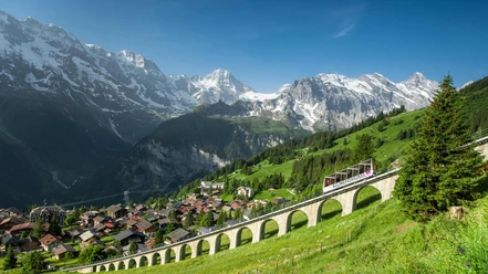
- Destination: Mürren, station
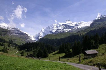
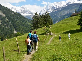
From Griesalp, the trail initially steadily leads southeast. After a short time, Bundstäg is reached, where you cross the Gamchibach. Soon after, you pass the junction to the direct path to the Sefinafurgga. It is shorter and less strenuous but also significantly less scenic. On the second half of the path to the Gspaltenhornhütte SAC, the ascent becomes steeper. After about 7 kilometers and just over 3 ½ hours, the hut is reached. It lies at 2454 m above sea level and was rebuilt and expanded in 2014 for almost 1.8 million Swiss francs. After a short refreshment on the hut terrace, you walk back the last stretch until you reach the trail to Sefinafurgga again. The higher you ascend from here—once briefly over a ladder—the rougher and rockier the area becomes. You pass the highest point before the Sefinafurgga, to which you descend shortly. It is worthwhile to linger at this airy spot.
For hikers with knee problems, the most difficult part now follows. The first section is exceptionally steep but soon mastered. The further descent to the Rotstockhütte is comparatively easy. Those who found the wild beauty of the rocky landscape around the Sefinafurgga almost terrifying can now switch to enjoyment. From the Rotstockhütte, the mountain hiking trail becomes a relaxed high path offering breathtaking views of the Lauterbrunnen Valley. This part of the hike ends at Bryndli. Now you must stay attentive on the short and steep descent to Spilbodenalp. The last approximately three kilometers to Mürren offer little in the way of scenery and therefore become all the more tiring—the station seems never to come. Because the hike is long and physically demanding, it is worthwhile to divide it into two days and stay overnight at the Gspaltenhornhütte SAC. Early bookers may be lucky to secure one of the coveted double rooms.

Good to know
Pavements
Best to visit
Directions
Equipment
Directions & Parking facilities
Outbound: PostBus from Reichenbach in Kandertal to Griesalp, Kurhaus
Return: from Mürren BLM by train and cable car to Lauterbrunnen and Interlaken Ost
Additional information
Berner Wanderwege, 031 340 01 01, info@beww.ch, bernerwanderwege.ch
License (master data)
Safety guidelines
Map
swisstopo hiking map 264T Jungfrau 1:50 000
Nearby

")
")