To the Gurbsgrat in the Diemtigtal


- 4:30 h
- 12.25 km
- 740 m
- 990 m
- 1,156 m
- 2,108 m
- 952 m
- Start: Nüegg
- Destination: Schwenden
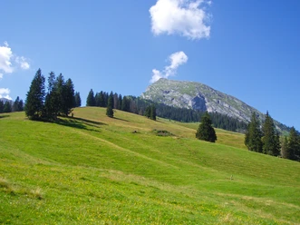
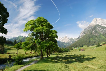
From the Nüegg mountain station, a paved alpine road leads to the Alp Schwarzenberg (mountain restaurant). The view of the towering Wiriehore, Homad, Turnen and Abendberg as well as the Niesen range becomes ever more impressive. At the hut, ascend over the broad Egg, which stretches up to the Wiriehore. At the Tubelfärrich signpost, the path turns into the eastern flank of the Wiriehore, leads almost level to the Alp Abendmatte, and ascends through a wide, swampy alpine pasture valley to the large alpine hut Gurbs-Mettenberg. Passing the walls of the Wiriehorn, the Tierlaufhorn and Gurbsgrat are visible. Through a partly scree-covered slope it now goes westwards to the ridge saddle at P.2031. Slightly ascending again, the mountain path leads through the eastern flank of the Tierlaufhorn to the Gurbsgrat. Here a magnificent view opens up. In the valley lies the long hollow of the Alp Gurbs, beyond which you can see the Männliflue, the Albristhorn, the Giferspitz, and the cliff peaks of the Spillgerte group. The snowfields of the Wildhorn and the Diablerets massif shine brightly. On a narrow path, one crosses the steep western flank of the Gurbsgrat (caution especially on wet ground!) and descends, finally at the edge of a swampy hollow, to the large alpine hut Oberste Gurbs. Following the alpine path past the Alp Underste Gurbs, descending through the Gurbstal to the main road. The bus stop Schwenden, old schoolhouse, is only a few hundred meters downstream. Those who continue further on the hiking trail to Schwenden Fildrichbrücke reach in the end the beautifully laid out valley hiking trail.

Good to know
Pavements
Best to visit
Directions
Equipment
Directions & Parking facilities
Arrival: by bus from Oey-Diemtigen station to Riedli, base station Wiriehorn
Return: by bus from Schwenden i.D., Fildrichbrücke to Oey-Diemtigen station
Additional information
Literature
License (master data)
Safety guidelines
Map
Nearby