Valley hike close to the water


- 3:50 h
- 15.90 km
- 100 m
- 670 m
- 670 m
- 1,227 m
- 557 m
- Start: Schwenden i. D. / Grimmialp
- Destination: Oey-Diemtigen
From the PostBus terminus Grimmialp, the hike initially leads a few hundred meters downstream into Senggiweid and to the idyllic Blauseeli, which fascinates with its deep blue color. The path then follows the Senggibach downstream to Schwenden schoolhouse and to the Fildrich stream, which you continue to follow. Below Tiermatti is the water playground «Gwunderwasser». After two stream crossings, you reach the cattle show area Anger. A roundwood hut with a barbecue area offers shelter and seating. The route then mostly follows the cool forest edge and the stream. Over Wampfle and Chollerebrügg you reach Horboden, where the Fildrich flows into the Chirel. The last section before Oey impressively shows the power of the water, which here, after the last major flood, has been given plenty of space in a revitalized river landscape. Shortly before the village of Oey, the path passes the fire pit Katzenloch. After crossing the stream and the main road, you arrive at Oey-Diemtigen railway station.
Background: The hike leads through the regional nature park Diemtigtal. This encompasses the entire valley and is characterized by diverse flora and fauna, traditional alpine farming, and lived culture. Highlights include wild romantic places like Lake Seebergsee. Golden eagles, black grouses, Alpine longhorn beetles, and rare reptile species are part of the animal world. Closely connected to the valley is the former wrestling champion Kilian Wenger. In Springenboden, there is a themed trail celebrating the wrestling tradition of the region.

Good to know
Pavements
- Street (6%)Asphalt (6%)Path (55%)Trail (32%)Gravel (1%)
Best to visit
- suitableDepends on weather
Directions
- Grimmialp – Schwenden i. D. – Zwischenflüh – Riedli – Horboden – Oey
Equipment
We recommend the following equipment: Light trekking shoes, light backpack, sun protection, rain jacket, first aid kit, light picnic, sufficient fluids, mobile phone.
Directions & Parking facilities
- Public transportationOutbound trip: by bus from Oey-Diemtigen to Schwenden i. D. / Grimmialp
Return trip: by bus from Oey-Diemtigen Additional information
- Berner Wanderwege, 031 340 01 01, info@beww.ch, bernerwanderwege.ch
Literature
License (master data)
Author´s Tip / Recommendation of the author
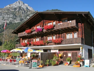
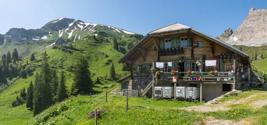
- Thanks to numerous PostBus stops along the way, the hike can be individually adjusted. There are several resting places and barbecue spots along the route. At the water playground «Gwunderwasser», children and adults alike can play and splash to their heart's content. A quiet zone with wooden loungers also invites you to relax. The Diemtigtal is, by the way, characterized by numerous beautifully designed and richly decorated wooden houses. You can admire these on the way, as part of the hike follows the Diemtigtaler House Trail, which presents outstanding examples of old carpentry craftsmanship.
Safety guidelines
- This route runs exclusively on marked paths of the hiking trail category.
Map
swisstopo hiking maps: 253T Gantrisch, 263T Wildstrubel