Leisurely hiking where seconds count in ski racing
- 1:45 h
- 5.92 km
- 260 m
- 43 m
- 1,232 m
- 1,434 m
- 202 m
- Start: Adelboden, Oey bus stop
- Destination: Adelboden, Unter dem Birg
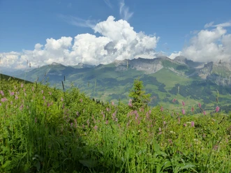
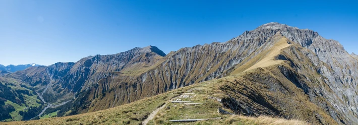
At the starting point of the hike, follow the signpost labeled Luftseilbahn Engstligenalp, later Unter dem Birg. After a few steps, cross the Allenbach and turn left. Shortly after, the route turns right onto a footpath. In addition to the yellow signage, an oversized wooden signpost with carved lettering recalls the construction of the approximately 4 km long path between 1983 and 1985. In the immediate vicinity of the Entschlige, a shady path now leads upstream along the stream. Soon the view falls to the left on the Chuenisbärgli. Every year, World Cup men's ski races in the disciplines of slalom and giant slalom are held here. The latter is considered one of the most difficult giant slalom courses. The path continues in a winding form. This allows for a restorative and relaxing hike. After the Raufmatte bridge, the view opens to the impressive Entschligefäll. About one kilometer later, you reach a junction where both continuing directions are labeled Entschigefall. You choose the route branching right via Chäli. This not only avoids a section with hard surface but also leads closer to the Entschligefällen. A few steps later, the Entschlige is crossed and a left turn is taken. After a passage over a pasture and through the forest, a footbridge crosses the mountain stream. Two junctions of mountain trails to Engstligenalp follow. These are ignored, continuing on to Unter dem Birg, the destination of the hike.

Good to know
Pavements
Best to visit
Equipment
Directions & Parking facilities
Outbound: by train to Frutigen and by bus to Adelboden Oey
Return: by bus from Adelboden Unter dem Birg via Adelboden Oey to Frutigen and onwards by train
Additional information
Literature
Short Hikes Guidebook 2 of the Bern Hiking Trails, order at: https://www.wanderplaner.ch/sommer/web-shop/
License (master data)
Safety guidelines
Map
Swisstopo hiking map 263T Wildstrubel 1:50'000, order at: https://www.wanderplaner.ch/sommer/web-shop/
Nearby