On the world-famous Lauberhorn route


- 2:50 h
- 6.77 km
- 850 m
- 1 m
- 1,276 m
- 2,062 m
- 786 m
- Start: Wengen
- Destination: Kleine Scheidegg
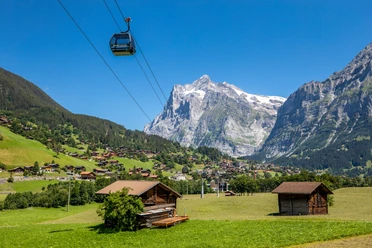
In front of Wengen station rises a small hill equipped with resting benches. Already from here, one can guess the wonderful view of the Jungfrau massif that the ascent to Kleine Scheidegg will allow: the brightly white pyramid of Silberhorn, the mighty flank of Männlichen, and the distinct trough form of the Lauterbrunnen valley particularly capture the gaze. Starting from the station, you ascend on the path following the tracks and continue through the underpass out of the village. Hard surface ends already before the houses in the area called In Gassen. Along the forest edge and over alpine pastures, you continue to ascend past the Allmend stop. Magnificent is the view back to the sunny terrace of Wengen. While situated at around 1300 m, Wengen does not reach the sea level altitude of Mürren, but like Mürren it is low-traffic and prides itself on its wind-protected climate.
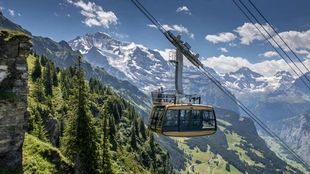
Through an underpass, you switch to the other side of the Wengernalp railway. Through spruce forest and over meadows, you continue moderately upwards. The firn summit of Silberhorn shines dazzlingly white between the treetops. Slightly above Baawald, at the so-called Wasserstation, the route touches the Lauberhorn downhill piste.
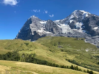
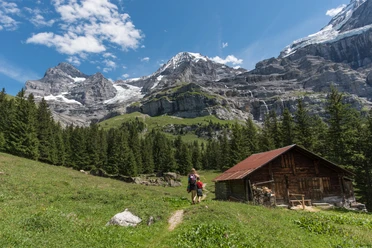
The path now turns east, and the ice giants Jungfrau, Mönch, and Eiger gradually come into view beyond the Trümmelbach. But also impressive is the view into the Sefinen valley framed by Gspaltenhorn, Bütlasse, and Schilthorn, which one enjoys from Wengernalp station (to Lauberhorn 1h40; to Staldeflue–Wengen 1h50). The path again switches to the other side of the railway line and follows it gently ascending past the Wengernalp lake to Kleine Scheidegg (to Lauberhorn 1h10). Along the way, the mountain silence is now and then interrupted by the dull rumble of ice avalanches thundering down into the depths.

Good to know
Pavements
Best to visit
Directions
Wengen - Allmend - Baawald - Wengernalp - Kleine Scheidegg
Equipment
We recommend the following equipment: lightweight trekking shoes, light backpack, sun protection, rain jacket, pocket pharmacy, light picnic, sufficient fluids, mobile phone.
Additional information
Association Bernese Hiking Trails, Bern, Tel.: 031 340 01 01, E-Mail: info@beww.ch, Homepage: www.bernerwanderwege.ch
Literature
Hiking suggestion from the hiking book Jungfrau Region Brienzersee - Oberhasli, hiking book series of the Bernese hiking trails
License (master data)
Safety guidelines
This route runs exclusively on marked paths of the hiking trail category.
Map
Swisstopo hiking map 1:50,000 254T Interlaken
Nearby